- Colorado HIGH SKY
- Posts
- The City and The City
The City and The City
Instead of traveling outward, I went inward through the city into the heart of industry.
Chris Pitchford
May 05, 2025
(About the title: The City and the City is originally the title of a 2009 book by China Miéville where the setting and the theme considers two cities, side-by-side, but each inaccessible from the other.)
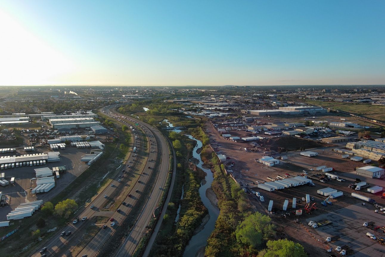
On a Friday morning, I journeyed in a different direction, undertaking different risks in a departure from the usual. However, the last time I was in Commerce City I visited Barr Lake in a rural setting. This time would be different. Sand Creek is a narrow ribbon of green in Commerce City, a heavily industrialized part of the Metropolitan Denver area.
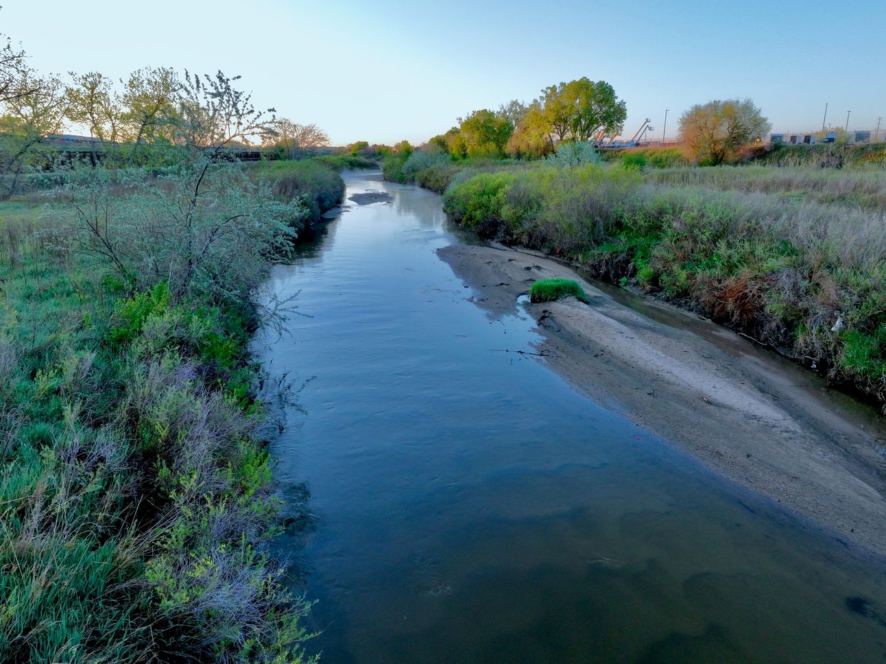
Sand Creek in Commerce City, Colorado, taken 2 May 2025 using a DJI Mavic 3 drone.
The silty creek bed runs shallow in this controlled drainage area, before Sand Creek empties into the South Platte River to the west. Paths for bikes and pedestrians follow the creek, as does the highway linking the both interstate highways in Colorado.
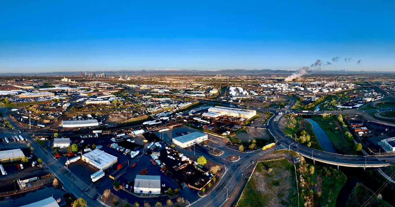
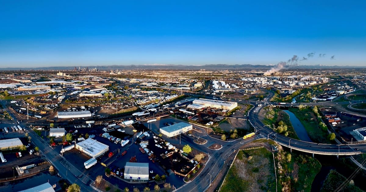
Panorama looking southwest across portions of industrial Commerce City and Denver.
I took off to fly at sunrise, and the dark yielded to a clear sky shining on the factories, furnaces, warehouses, refineries and acres and acres of pavement of the area. Nestled within all the concrete and steel is a tiny ribbon of clear water, seemingly impervious but not at all invulnerable.
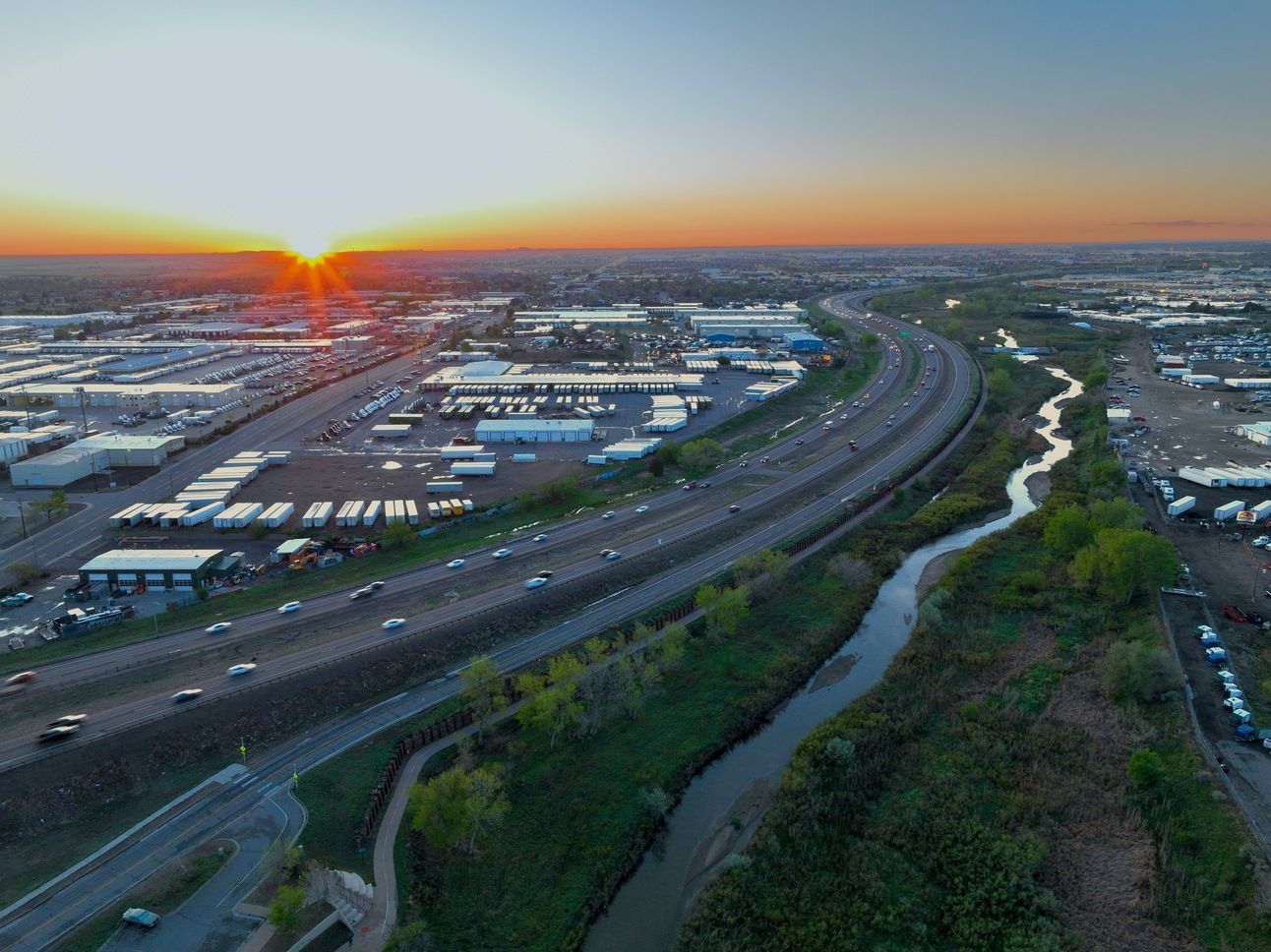
Sand Creek, I-270, and Commerce City at sunrise.
The views of the Rocky Mountains from over Commerce City have a unique perspective, as shown in the following photograph. Earlier, I mentioned a clear sky, but you might notice some dark clouds over the view of the distant Indian Peaks above the Flatirons.
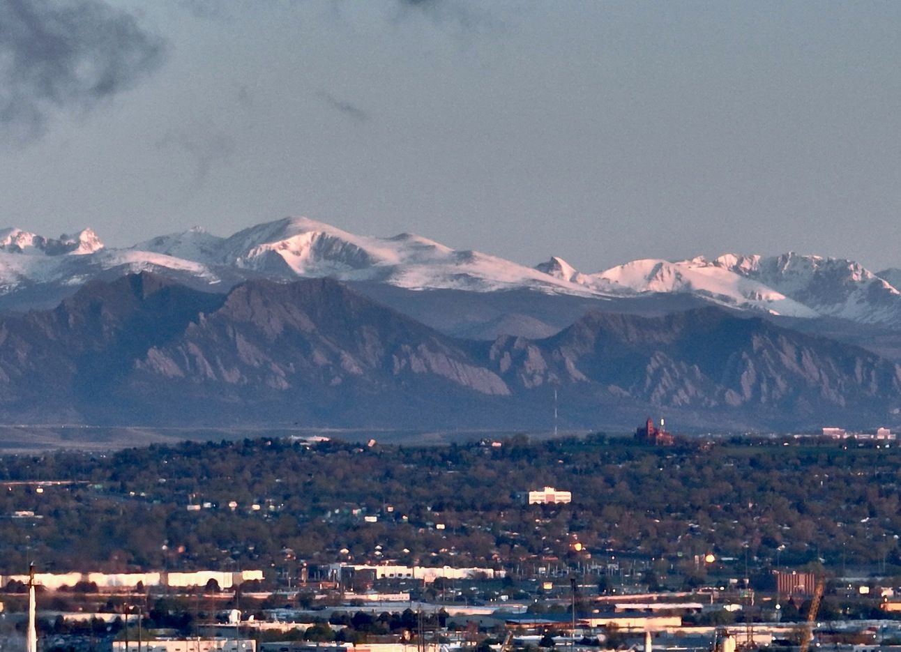
Looking northwest over Thornton to the Flatirons, and Indian Peaks, with local clouds?
The following view of the sun after it had risen shows a clear sky above the control tower at Denver International Airport.
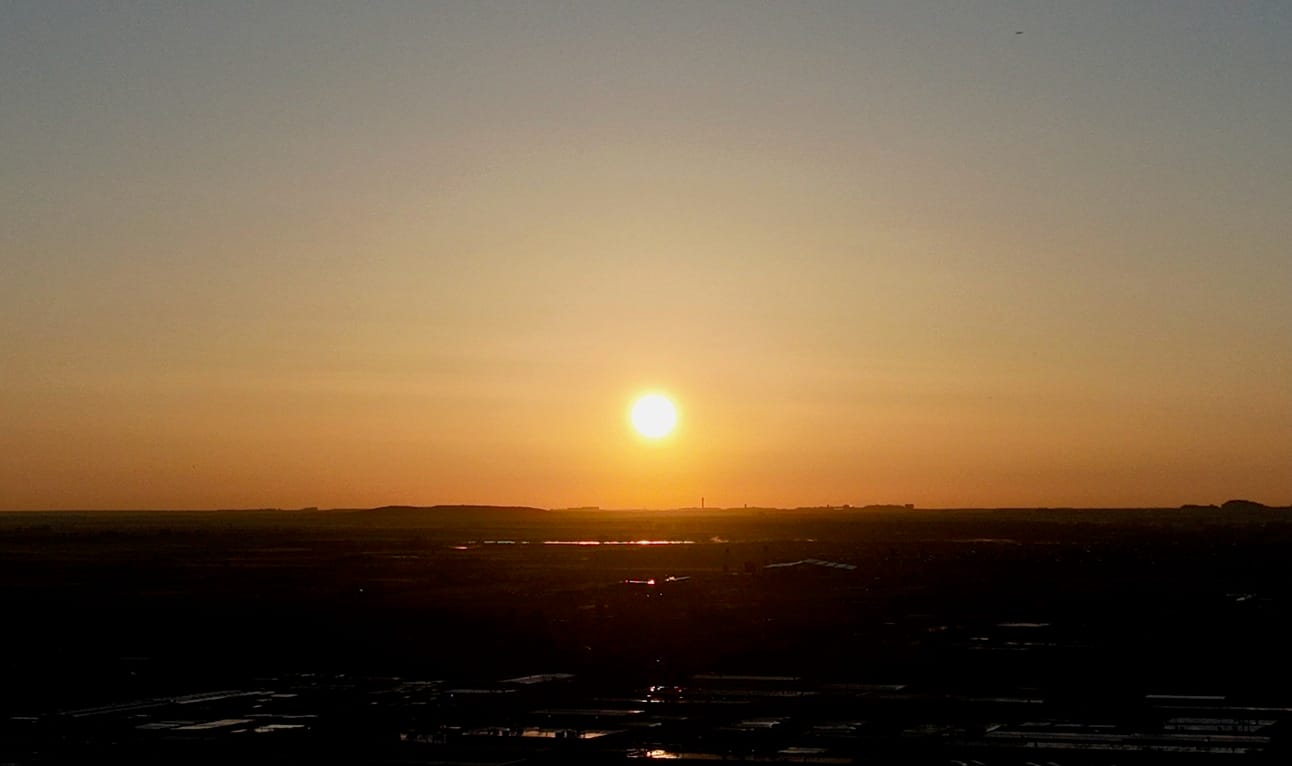
Morning sun over Denver International Airport on the horizon.
Where are those clouds of vapor coming from? A utility power plant, run by Xcel Energy, uses natural gas to drive a steam turbine, and the heat exchanger pumps vapor into the morning air. When I tried to take a picture of the power plant, another lucky surprise appearance transformed the photograph.
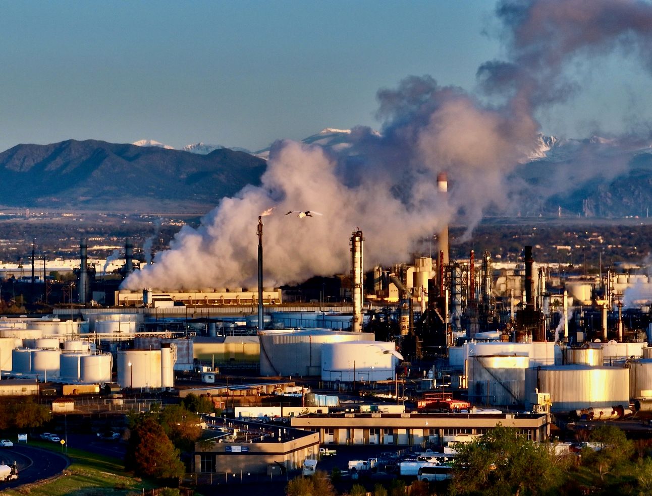
Two cranes fly in front of the Suncor refinery and Xcel power plant.
The clouds I mentioned earlier are clearly the product of the power plant’s heat exchanger. In this series of photos, the plant is behind the Suncor refinery for processing petroleum, in a facility dominated by tanks holding it and other substances. However, if you take a closer look you will see two birds who have joined the picture, already in progress. Here’s a portrait layout showing the detail from the above photo.
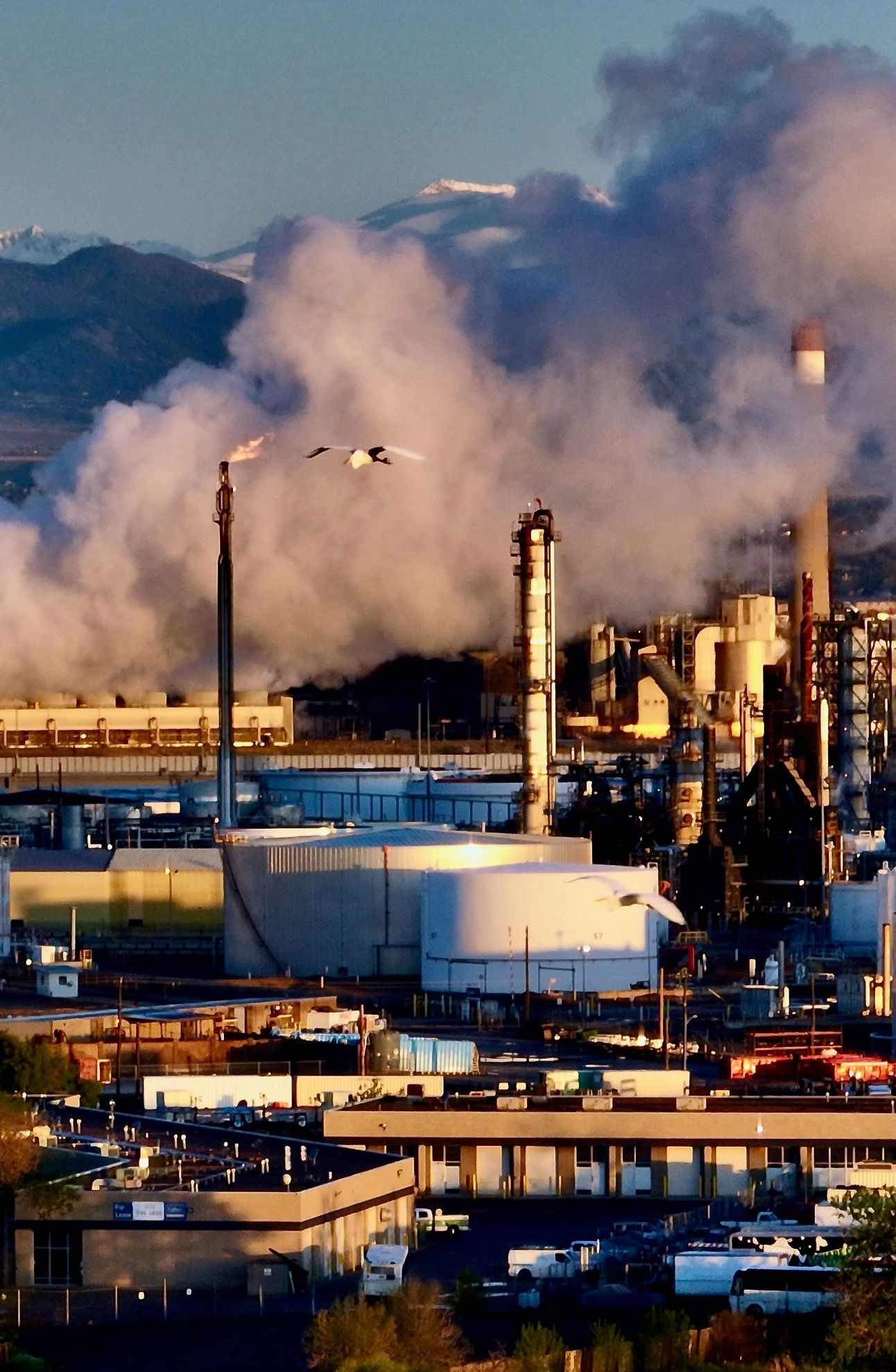
The heat exchanger is about a mile behind the gas jet, with me and the drone another mile away.
The birds were almost a half mile away from me, and at the time I mistook them for sea gulls. It appears that there were two cranes, maybe part of a migration of thousands of sandhill cranes that had convened in southern Colorado last week whose images were shared in photographs online. Was this a mated pair looking for a place to nest? A place to rest, more likely, on their way to wherever they’re going.
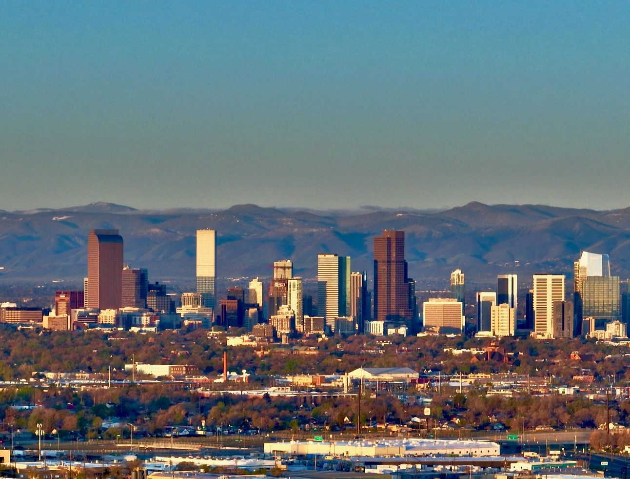
Downtown Denver as seen from above Sand Creek in Commerce City.
I had traveled deep into the industrial part of town to see things from a different angle, including the Colorado State Capitol from a view opposite of the side of town where I live. The traffic, noise, and smells all confirmed the constant industrial activity.
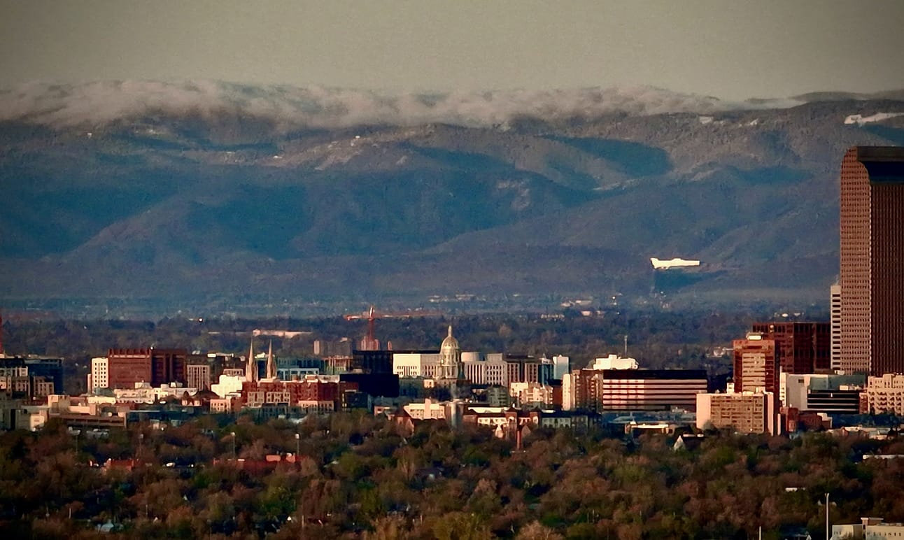
State capitol at center, with fog over Kennedy Gulch and South Platte River in the Foothills.
In the midst of all this, there is a filter of a sort, both natural and spiritual, to see the beauty that exists. Like a colony of plants clinging to a sandbar along a stream, the time may be limited but the opportunity is now.
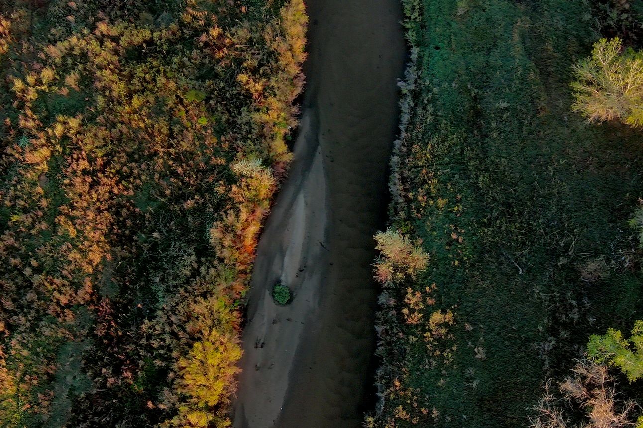
Sand Creek, seen from above, taken with an Autel Robotics Evo Lite+.
Spring has sprung, and while I was in Commerce City, I was sharing and intersecting my own tiny world with all the others who shared theirs.
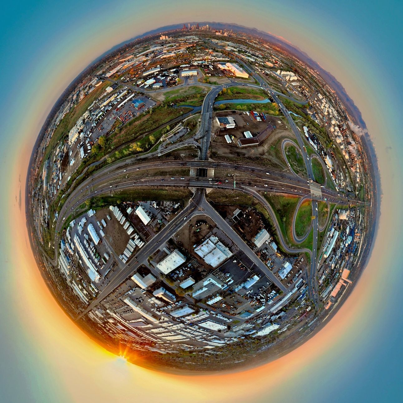
360° panorama of Sand Creek, from over 56th Avenue and I-270.
While the whole city itself seemed in motion, it moved slowly, densely, sluggishly. Traffic lurched underneath the drones in unpredictable waves, as the sun rose surely into the new day.
The view southeast, towards the old airport, now a neighborhood of its own.
Thanks for reading all the way to the end, and I look forward to hearing what you think!